TROPICAL CYCLONE TECHNICAL BULLETIN: AUSTRALIA – EASTERN REGION
Issued by BRISBANE TROPICAL CYCLONE WARNING CENTRE
at: 1835 UTC 09/03/2009
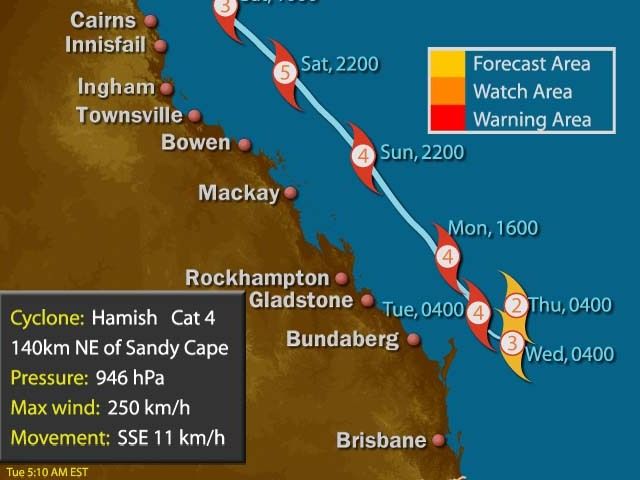
Name: Severe Tropical Cyclone Hamish
Identifier: 17U
Data At: 1800 UTC
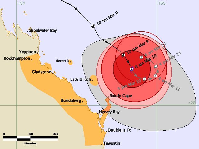
Latitude: 23.7S
Longitude: 154.1E
Location Accuracy: within 10 nm [19 km]
Movement Towards: south southeast [151 deg]
Speed of Movement: 6 knots [11 km/h]
Maximum 10-Minute Wind: 95 knots [175 km/h]
Maximum 3-Second Wind Gust: 135 knots [250 km/h]
Central Pressure: 946 hPa
Radius of 34-knot winds NE quadrant: 120 nm [220 km]
Radius of 34-knot winds SE quadrant: 120 nm [220 km]
Radius of 34-knot winds SW quadrant: 120 nm [220 km]
Radius of 34-knot winds NW quadrant: 120 nm [220 km]
Radius of 48-knot winds NE quadrant: 75 nm [140 km]
Radius of 48-knot winds SE quadrant: 75 nm [140 km]
Radius of 48-knot winds SW quadrant: 65 nm [120 km]
Radius of 48-knot winds NW quadrant: 65 nm [120 km]
Radius of 64-knot winds: 40 nm [75 km]
Radius of Maximum Winds: 15 nm [28 km]
Dvorak Intensity Code: T6.0/6.0/S0.0/24HRS
Pressure of outermost isobar: 1006 hPa
Radius of outermost closed isobar: 100 nm [185 km]
Storm Depth: Deep
FORECAST DATA
Date/Time : Location : Loc. Accuracy: Max Wind : Central Pressure
[UTC] : degrees : nm [km]: knots[km/h]: hPa
+12: 10/0600: 24.1S 154.6E: 040 [075]: 085 [155]: 954
+24: 10/1800: 23.9S 154.9E: 070 [130]: 070 [130]: 966
+36: 11/0600: 23.6S 155.0E: 100 [190]: 055 [100]: 979
+48: 11/1800: 23.3S 154.4E: 135 [250]: 050 [095]: 984
+60: 12/0600: 23.1S 153.4E: 180 [340]: 050 [095]: 985
+72: 12/1800: 23.1S 152.1E: 230 [425]: 050 [095]: 984
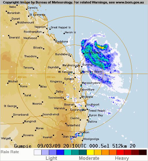
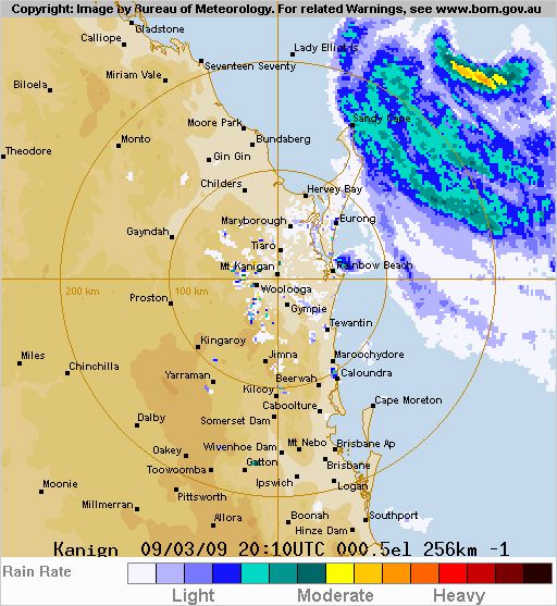
REMARKS:
The effects of increasing NW shear are becoming evident on satellite images as a
cirrus outlfow boundary contracting towards the centre of the system. However
vigorous convection is still maintained around the eyewall. DT 6.0 based on eye
pattern with white surround and light grey eye.
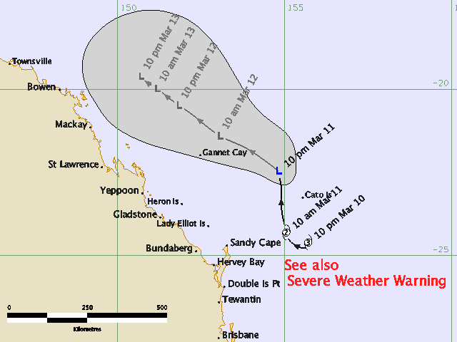
Expect slow movement and a change in motion generally towards the west in the
next 24 to 48 hours.
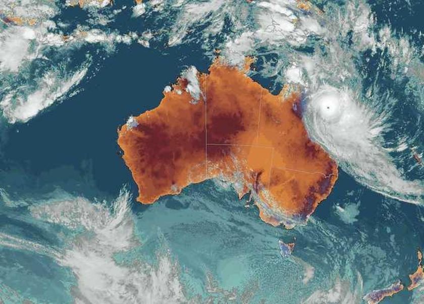
It was not looking good at this stage
TROPICAL CYCLONE INFORMATION BULLETIN
For 11.00 PM EST on Wednesday the 11th of March 2009
At 10 pm EST Wednesday, Ex-Tropical Cyclone Hamish with central pressure 998 hPa
was centred near latitude 22.4 south longitude 154.8 east, which is about 295 km
north northeast of Sandy Cape.
Tropical Cyclone Hamish has weakened through today and this evening, and is now
below tropical cyclone strength. The low level remnant of the cyclone is
currently moving to the north and is expected to curve onto a northwest track
over the next 48 hours, remaining parallel to the Queensland coast, and continue
to gradually weaken.
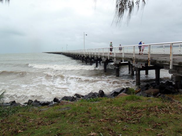
A large high pressure system over the western Tasman Sea in combination with
Ex-Tropical Cyclone Hamish is producing strong to gale force winds and large
waves about the southeast Queensland and Capricornia coasts. A separate Severe
Weather Warning remains current between Yeppoon and Coolangatta for these
conditions.
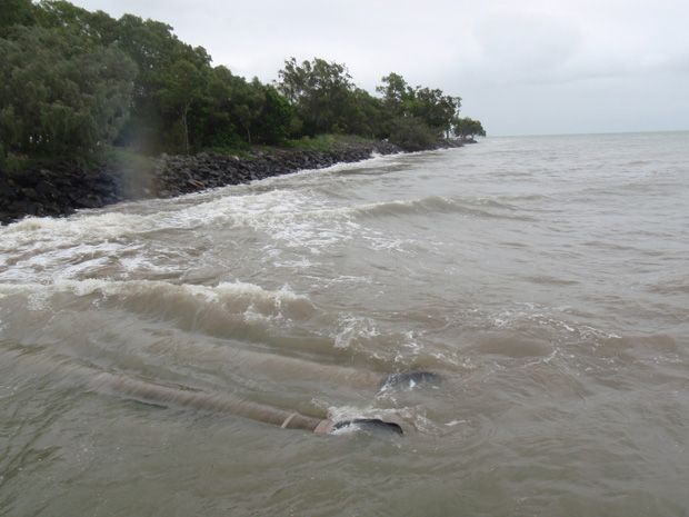
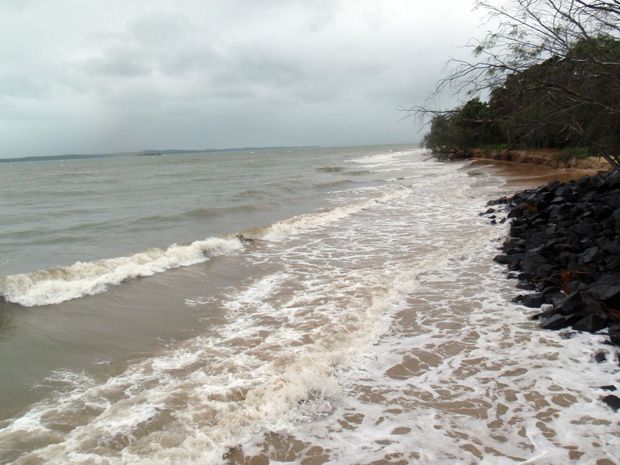
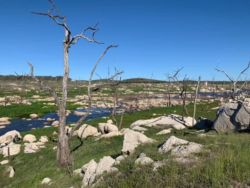
Saved this time
May take a few weeks before we get any fishing in again though – Scotto